Author Archive

Angas River Scenic Drive

9 September 2021

We departed Strathalbyn at 7.30am in sunny weather with a blustery head wind. The commuters to Adelaide were hogging the road until we turned off towards Macclesfield where, according to the sign, we joined the Angas River Scenic Drive. The river is more picturesque upstream of Strathalbyn, but we didn’t see too much of it. Its headwaters are near Macclesfield – however the Angas River Scenic Drive continues all the way to Mylor and beyond, by which point you are in the Onkaparinga catchment.

Old Laucke Mill, Strathalbyn

It is a fairly steady uphill ride to Macclesfield, Echunga, Mylor and Stirling with a few flat sections and downhills. We crossed the Angas River on the way out of Strathalbyn, after which we remained on its true left bank. Early spring following a wet winter is a good time to be in the Adelaide Hills. Everything is green, dams are full and rivers and creeks are flowing.

The road to Macclesfield

A magpie had a go at swooping us but we toughed out that challenging situation. In Mylor we stopped for morning coffee and were greeted by a group of old codger cyclists who were riding past. Several of them had gone a bit crazy with the cable tie solution to the magpie threat. Hope it’s working for them!

Coffee at Mylor

Between Aldgate and Stirling we were passed in an unsafe way on double white lines by a number of motorists who could not be bothered to wait until there was a clear view of the road ahead – grrrr! We took the Bullock Track to Mount Osmond – last stretch on the gravel – before a nice fast ride down Hayward Drive and then home.

To Milang & Strathalbyn

8 September 2021

Today started out cold and sunny in Kanmantoo. We did a short tour around the town and found that there is more to it than you might think – new houses have appeared but the population is still well under 1000.

Kanmantoo cottage

Callington is only 5km away along the Old Princes Highway, a gentle downhill run. We timed our arrival to coincide with a goods train heading east to Melbourne.

Yay! a train!

The Callington Hotel is under renovation and looks set to re-open soon. The Bremer River flows through the middle of town, crossed by an old stone bridge. We found the St Peter’s Lutheran Church which has an unusual bell tower. The old Miner’s Church near the bridge is now a residence with Tesla battery installed.

Bremer River, Callington
St Peter’s Lutheran church

We continued south, took the freeway overpass and turned on to North Bremer Road which followed the river more or less. The Salem Lutheran Church came into view on the other side, traditional bluestone style with steeple and details painted white, so it stood out in the morning sun.

Salem Lutheran Church

We inspected a ford across the Bremer – looked pretty much like a homemade job and too steep to be much use for vehicles. In this area fields of canola are in flower, grain crops are well advanced, sheep are having lambs and cattle are getting fat.

We crossed a scrub-covered limestone ridge and were soon in the Langhorne Creek vineyards. The Bremer River floods this area regularly, giving the vines a good soaking. The most recent flood was in October 2016 when we had the big storms and blackouts in South Australia.

Wikipedia says ‘One recorded Aboriginal name for the Bremer River was Miochi.’ This might account for Meechi Road which links Woodchester and Langhorne Creek.

Langhorne Creek vineyards

The general store served good coffee that powered us up for the next stretch along Lake Plains Road to the mouth of the Bremer at Lake Alexandrina.

Bremer River near Langhorne Creek

Mouth of the Bremer River

We turned south towards Milang along Lake Road and, just before reaching the town, crossed the Angas River that also flows into the lake.

Milang has a bakery (unhipsterised) that serves good standard fare – pies, pasties, custard tarts, iced buns and lamingtons. The old railway station and lake-front fibro shacks are definitely worth a look. On the edge of town a small jetty had been taken over for relaxation activities by pelicans (feather preening, beak clacking and neck stretching) and cormorants (wing drying).

Milang Railway Station
Shacks at Milang
Pelicans and cormorants

We headed for Strathalbyn, following the Angas River as closely as possible, which wasn’t very close at all. When we were able to observe it, it appeared to be a rather degraded waterway, much of it bereft of red gums and any original vegetation.

Our overnight accommodation is the Victoria Hotel, overlooking the Soldiers Memorial Gardens in Strathalbyn.

Following the Bremer River

7 September 2021

NSW and Victoria are locked down. In South Australia we are not locked down … yet! The weather is nice and we can visit the countryside. We decided to do this on our bikes with the idea of following the Bremer River from source to its mouth at Lake Alexandrina. Three days.

First step: get to Harrogate which seemed to be near enough to where the Bremer rises. We set off from home in cold overcast conditions and rode up Norton Summit Road – no koalas spotted, but we were passed by several young male cyclists who were travelling at a higher velocity than us.

Norton Summit

We went through Ashton (PO cafe closed on Tuesdays) and on to Uraidla where the Republic Cafe served us with mediocre coffee (tepid). Luckily the pastries were acceptable.

Uraidla – pastries good, coffee bad

Then on to Carey Gully, Deviation Road and Collins Hill Road – steep downhill past brimming full dams and bare orchards that will soon come into leaf.

Collins Hill Road

A few more climbs and descents brought us to Woodside where we patronised the Lobethal Bakery (Woodside branch) – nice pretzels available there!

We took Bird in Hand Road towards Harrogate, past vineyards and wineries. We could see evidence of the December 2019 Cuddlee Creek fire – Mount Torrens to the north still covered in tree skeletons, BlazeAid signs, blackened trees and piles of timber from burnt trees that have now been cut down. Other prominent features were the towers on Mount Beevor and, to the south, the rocky ridge of the Mount Barker summit.

BlazeAid, trees, cows – and in the distance (trust me) a view to the Lower Lakes
Ruined church, Bird in Hand Road


There were a couple of steep downhill runs into Harrogate, a small settlement with a classic Besser brick hall adjacent to the original bluestone hall, now the Supper Room. Here we had our first sighting of the Bremer River, already well formed and with plenty of water. The true headwaters are 12 km away, just south of Mount Torrens at 430m. We admired an impressive red gum by the bridge and enjoyed the froggy chorus.

Harrogate Soldiers Memorial Hall and Supper Room
Bremer River and red gum, Harrogate
Feature of Harrogate – largest collection of lawnmowers ever seen (by us)

By road it is not possible to follow the river closely at all times so we chose a route that did the job near enough. We took The Glen Road, a gravel road that crosses on to the true left bank of the Bremer. Further along, on the Bremer Valley Road, the old bluestone Bondleigh Hall stands in a dilapidated state by the road with Mount Barker on the horizon to the west. Plantation Road then took us past an old bluestone quarry, across the Bremer again, and into Kanmantoo on the old Princes Highway.

The Glen Road – the dot in the distance is Ian
Ruin with blossoms on The Glen Road
Dry stone wall on The Glen Road
Bremer River Road – Bondleigh Hall, Mount Barker in the distance

This small town has few offerings – we had already found a place to stay, but no dinner was available. There is a general store & PO. Luckily we didn’t rely on it to provide because it would have been unsatisfactory – there are hardly any groceries on the shelves! We planned ahead though and brought fish curry and rice from home. The microwave was coaxed into performance and we are now fed!

Penola to Mount Gambier

29 September 2020

Ian’s brand new Schwalbe Marathon tyre proved to be faulty, causing a flat front tyre. Luckily he was carrying a spare, which is not our usual habit. While he fixed it I did a tour of Penola and got swooped about 6 times by a magpie.

We rode out of town, crossed over the new bypass that now keeps heavy vehicles away from Penola’s main street, and took the Mount Burr Road. Along the way a kangaroo was racing us and winning, probably doing 25 kph, until it decided to cross the the road ahead of us. It lost its footing on the bitumen and fell on to its side on the road, scrambled around to regain its composure and then took off again in the opposite direction.

Our objective along here was to find the small track that would bring us to the farm that used to belong to my grandparents and where we spent much time as children. After one navigational error we found it – a 2 wheel track that was rideable despite being muddy (not the sticky kind), grassy and wet.

The farm house built around 1960 is still there but the shearing shed and other buildings are now gone.

A tail wind helped us to reach Lake Leake, formed by volcanic activity. There is a picnic shelter with rainwater tank, barbecue, toilets and camping area here.

We stopped to eat a giant bun from the Penola bakery then continued past dairy herds, pine trees and old farmhouses to the Glencoe shop where tea was available. The massive old limestone Leake Brothers Woolshed is nearby.

Glencoe apparently had a Catholic/Anglican rivalry with the two small old limestone churches adjacent to each other – no longer in religious use of course.

From Wandilo we followed the old railway line to the outskirts of Mount Gambier where it becomes a rail trail into the town. For anyone interested in industrial activities, factories and warehouses this is an ideal route. The old railway station precinct has been transformed over several years into a community recreation area.

We checked out the Blue Lake – still looking good – before meeting Gary (trumpet player) and Penny whose company we enjoyed over an excellent meal.

The bike tour is now done – travelled 465km in total. We will return to Adelaide on the bus tomorrow.

Naracoorte to Penola

28 September 2020

We returned to yesterday’s cafe for a big breakfast and found the police and ADF border patrol at the next table, all talking shop. There were 4 police motorbikes parked outside our motel this morning so they are obviously on border duties as well.

It was a sunny cloudless day. We headed south via Naracoorte Caves where we declined to go underground and took a brief glance inside the visitor centre instead. Everywhere the countryside is green and damp with shallow swamps and water lying beside the road. We got another small sheep stampede going and inspired some Black Angus cows to gallop along beside us on their side of the fence.

The vineyards of Joanna and Wrattonbully are showing a tinge of green as the first leaves are just bursting out.

Sulphur crested cockatoos have screeched at as constantly for the past 4 days. They were less numerous today, and instead we saw large flocks of ibis on the wing, got swooped by a couple of magpies (freaked Ian out!), saw some yellow tailed black cockies and heard some kookaburras.

Near Wrattonbully there is a border track about 10km long that looked like our sort of road, so we headed out there to check it out. The police officer at the border advised against taking this route as it is technically in Victoria and we could therefore be fined and forced to quarantine etc.

Instead we found another adventure route through Comaum Forest, a pine and eucalypt forest area. The first part was hard dirt, followed by a soft sandy section that we had to walk, after which it was rideable again. We saw a wallaby and lots of purple cockatoo orchids. 

The track delivered us back into farmland and then the Coonawarra vineyards, after which we joined the Riddoch Highway for the last 6km into Penola.

The Royal Oak Hotel, where we had booked a room, was closed – ie not operating (temporary situation related to COVID-19). This was worrying, but enquiries at the bottle shop revealed that the accommodation was available. We had to wait an hour or so to get the keys, then once inside found that there was no hot water. An aperitif on the balcony (one of the best you will find anywhere) filled some time while they rectified that. We are the only people in this entire building! We dined at the other hotel which lacks both character and tartan carpet.

Royal Oak Hotel, Penola

Frances to Naracoorte

27 September 2020

On my post-breakfast circuit around town I conversed with a dressing gown-clad mother and daughter who were enjoying an early morning cuppa and cigarette by their front gate. We agreed that the strawberry farm, the about-to-reopen hotel and the peaceful countryside made Frances a pretty good place.

We rode south past fields of lupins and clover and set a paddock full of sheep into a minor stampede. A short detour off the road took us to Binnum where there is a police border post with an ADF member also on duty, with army tent and campfire. We requested fresh damper but it was not available – apparently it is not included in basic training these days.

Binnum has a little post office (long closed) and an old corrugated iron hall that is used for fitness classes that are overseen by a photo of a young Her Majesty the Queen! We looked for remnants of the old railway siding and found only an old signals box that is falling over.

Next point of interest was Mullinger Swamp Conservation Park, a few kilometres down an unsealed road, situated right on the border. More than half of the swamp is in Victoria. It is holding quite a lot of water and attracting small ducks and seagulls. We circumnavigated it along a 2 wheel track. This was inundated at one point, requiring the removal of footwear, and too sandy for riding for a stretch after that. A SAPOL patrol vehicle came through (2 of the blokes we met at Frances) but they turned back rather than risk getting bogged. So we have been to Victoria and back to SA!

The biggest red gum tree in the South East is nearby. It is an impressive example although all the other red gums around were also immense and worthy of admiration.

We passed through the small town of Hynam and reached Naracoorte in time for lunch. This town is overlooked by three churches – the Catholics and Anglicans claim equal status on top of the hill right next to each other. The old limestone Presbyterian church nearby has a steeple that gleams in the afternoon sun.

We checked out the swimming lake (empty but therefore useful for roller blading). Then Paul, Brodie and Eli met us for dinner after spending the day at Naracoorte Caves – and they are taking our camping gear back to Adelaide!

Mundulla to Frances

26 September 2020

We breakfasted at the Mundulla General Store which turned out to be just like something out of Lake Wobegon – it’s a hangout joint for local farmers. We chatted with those present including  the proprietor, a farmer from nearby Buckingham and two lycra-clad blokes who had ridden up from Padthaway. We found out that the Mundulla Tigers won the grand final – 3 in a row – a couple of weeks ago against South Gambier. Also the farmers are having a good season this year.

On the way to Wolseley we met two golden retrievers who came out to make friends with us and a large bull with a crumpled horn. More quiet roads, bright canola fields, avenues of gum trees and a cold wind.

Wolseley is a shadow of its former self but has a few things going for it. There are the WW2 fuel tanks, a history trail, a few old shops (none in business), the pub (still operating), silos (as yet unadorned by art work) and a nicely planted verge along the main street. The Adelaide to Melbourne railway line goes right through the town.

We met our second lot of doggy friends here – four massive Great Danes. Their owner, a man of diminished dentition, was keen to tell us about the dogs as well as his interesting sculptures made from rusted steel.

Another encounter with mud occurred. We tried to leave the town on a dry weather road but after a short distance had to turn back and clean out our mudguards and scrape our tyres. No more muddy tracks!

Getting to Frances was a matter of following the road alongside the old Bordertown to Mount Gambier railway line that closed about 30 years ago. It runs through sheep and cattle country, pine plantations and the Bangham Conservation Park.

The old Geegeela siding

Frances is a pretty small place. The hotel is currently closed but gearing up to reopen soon under new operators. The general store (it is on the market) had closed for the day by the time we arrived. Dinner options were looking pretty limited, a situation we had anticipated. Fortunately Frances Strawberries saved us from complete reliance on our camping rations. This establishment provides light meals, drinks and produce so we could get a beer and brownies and lemon tart with cream to bring back for dessert. 

We paid a quick visit to the SAPOL border unit who were located by the oval in a donga. The three police officers plus one ADF member had a cold and fairly quiet spot with a fire place but no fire going. They updated us on local traffic activities – not much happening – and expressed interest in our trip.

Willalooka to Mundulla

25 September 2020

The day dawned cold and sunny. The cold persisted while sun, clouds and rain showers took turns throughout the day.

We headed north along the Riddoch Highway, missed our turn and went to Christmas Rocks, a granite outcrop that is a local point of interest. We had seen similar but smaller granites along Petherick Road last evening as we approached Willalooka. A short retreat brought us to McGrice Road, a firm unsealed road with a biggish hill, followed by more gentle terrain. There were more granites of various sizes along this road, including one that was even better than Christmas Rocks, only in a less convenient location ie in the middle of someone’s farm.

Rowney Road led us towards Mundulla and would have taken us straight there but Google maps led us on a long cut, having located Mundulla in a paddock about 5km south of where it actually is. A tail wind put things right in a short time. We patronised the general store and overheard a conversation between 3 country blokes who expressed admiration and disgust for various people and events currently in the news, pretty much in complete antithesis to our own views.

After off loading our redundant camping gear in our minute cabin, we embarked on a tour of the area to take in some local natural features. The first was to have been Poocher Swamp, but our route there got us on to a rustic track made of mud that stuck to our wheels and clogged up our mudguards. Then a shower of rain forced a retreat into a hollow tree.

The tour was then shortened with a focus on reaching the Plaited Tree. We passed huge vineyards, canola fields, lupins and huge redgums and headed into the icy wind.

Another rain storm came through with a bit of hail thrown in. At last the renowned tree was reached. It is ancient and immense with several massive branches completely fused together. The story goes that the indigenous people of times long ago brought about this phenomenon by weaving the branches of the young tree together, but the veracity of this is not clear.

On arrival back in town we warmed up by the fire in the Old Mundulla Hotel and had an excellent meal, along with two parties of about 70 local residents – it was a big night for the kitchen staff who work in a tiny space.

Salt Creek to Willalooka

24 September 2020

We took the Stateliner bus from Adelaide to Salt Creek, halfway down the Coorong, to commence a 6 day tour of the South East, taking in some historical and natural locations of interest.

The first of these was Jip Jip Rocks Conservation Park, in the middle of nowhere with no facilities, therefore necessitating camping. So we packed our leaky tent and all the other items required including a fair bit of food. The weather forecast was not promising but the spirit of optimism prevailed and everything started out fine with some sunshine and a tailwind to launch us south along the Princes Highway.

The first dirt road stretch was along the Old Coorong Road, in good shape if a little damp. The are many shallow lagoons, all holding water at present.

Lagoon, Old Coorong Road

We startled a blue crane and an emu that panicked and ran away. Darkening clouds were gathering and rain began to fall as we rejoined the highway via a muddy track. Luckily the dense roadside teatree provided suitable shelter and after about 10 minutes we could continue.

Old Coorong Road

Dead animals – several kangaroos, a deer and a wombat.

We then took Petherick Road, an unsealed road heading east through green swampy farming country with sheep, Black Angus cattle and lots of drains. There has been an incredible investment of effort to ‘improve’ this swampy country by the construction of drains. Not sure how effective that has been.

We saw way too many rabbits scampering around, a fox and a deer. Then at one point we saw a massive herd of deer and briefly entertained the shocking idea that this was a wild herd until we saw high fencing indicating that it was a deer farm.

The herd of deer

The weather was not improving so Plan B was activated – ditch Jip Jip Rocks as the destination and head for the Willalooka Tavern (the Tav as we now know it). It was a long grind but we made it just before dark, pretty wet and covered with white mud from the road. Here we had comfortable accommodation and a meal beside a roaring combustion heater. All that camping gear … !

Wellington to Raukkan

1 July 2020

Today we had a 12.43pm deadline for a Stateliner bus pick up at Ashville on the Princes Highway. Before this we had to make the last ferry crossing at Narrung and get to Raukkan, then ride back to the highway, just under 70km in total.

We woke at 6am, had pre-dawn breakfast overlooking the river, then went to the ferry which was waiting on the other side. We had to ring several times to get the ferry operator’s attention.

Wellington Ferry

Then we smashed out the 20km to the Narrung turnoff in about an hour. As the next stretch was a return trip we hid our luggage in some bushes for unladen travel. The Poltalloch Road skirts Lake Alexandrina with reedy shallows on one side and green paddocks on the other. Black Angus cattle and sheep are raised in this region.

The historic Poltalloch Station, on the lake side, has a cluster of old limestone buildings and massive stone shearing shed with two arched gables.

Poltalloch Station

A hill just past the station, while at only 20m elevation, gives great views of the lake with the low blue backdrop of the Mount Lofty Ranges along the horizon. Mount Barker’s distinctive shape is a landmark.

The Narrung ferry is at The Narrows where Lake Alexandrina and Lake Albert meet. The approach through a small cutting opens out to reveal the ferry ahead and the Point Malcolm Lighthouse and cottages to the north. This is Australia’s only inland lighthouse and also our smallest.

Point Malcolm Lighthouse

The ferry operator was the second woman we have encountered in this role. The first was at Mannum. Most of the ferry operators we have met have been bearded men, a couple were clean shaven, many cheery of disposition and the odd taciturn character. 

We rode on through Narrung where we saw fishing nets laid out for repair. We reached Raukkan but did not enter the town as the road was closed except for local traffic, we assume because of the community’s need to be isolated from COVID-19. 

Made it to Raukkan!

Retracing our route, we collected our panniers and went to Ashville where we boarded the bus on schedule and returned home to Adelaide.

The slalom was a great trip that re-introduced us to the beautiful landscapes and towns of the River Murray in South Australia.

For the record, we rode 540 km and made 16 crossings of the Murray, 5 by bridge and 11 by ferry. And I say long may the ferries continue to convey us across the river. They are quiet, reliable and interesting. They make you pause and wait. The operators always give you a wave. Every ferry is named after a local bird species. They are a free 24 hour service. 


Mannum to Wellington

30 June 2020

Last night concluded with an meal at the Pretoria Hotel in Mannum in the excellent company of Ian’s former colleague Steph and her husband Tony, now resident in the region.

We breakfasted in Lovells Bakery where unpretentious fare is available and retro posters promote beneficial foods including toast.

A rolling topography took us out of town towards Murray Bridge along the quieter road through Caloote and Mypolonga. There are many of these tiny settlements along the river, mostly bypassed but surviving.

Highrisers on the farm fence near Mypolonga

The first river flats are just downstream of Mannum. Near here we met a herd of cows that pranced about energetically to celebrate our passing. We passed orchards of lemons and oranges, avocados and olives and an occasional abandoned dairy.

River views emerged and vanished. Conditions were sunny and cold – gloves on almost all the way to Murray Bridge.

A much needed lunch was consumed before today’s first river crossing over the Murray Bridge. At this point the slalom had to be modified as the next crossing, the Swanport Bridge, is not accessible by bicycle. So it was across and back for reasons of cycling amenity – we didn’t want to mix it with heavy transport to Tailem Bend. The Murray Bridge has a narrow pedestrian lane on both sides, just wide enough for us to ride across.

We paused halfway to watch a long freight train thunder over the rail bridge towards Melbourne. On the return I spotted another spoonbill in the shallows of the true left bank.

Spoonbill, Murray Bridge

The Murray Bridge Regional Gallery has recently reopened after the lifting of COVID-19 restrictions so we paid a visit to view the current exhibition – Darling River theme with portraits on tin by Justine Miller and linocut prints by Badger Bates. Highly recommended.

Mussel shells by Badger Bates

We then followed the Swanport Road to Jervois past green fields and river flats. The second river crossing for today was at Tailem Bend, another double back crossing to avoid unpleasant traffic conditions. The Tailem Bend ferry is possibly unknown by many as most of us join the freeway and head for the city from here. It delivers its passengers to the bottom of the river cliffs below the town.

As we waited on the true right bank we observed the levee that runs from Tailem Bend to Wellington. It looked like a better option than the road and research (Google maps) confirmed its continuity. So after a ferry ride over and back we rode the levee for the last 10km. This was a wonderful route, absolute river front with pelicans, flocks of ibis, moorhens, kangaroos leaping along ahead of us, raptors circling around, frogs chorusing and no traffic.

The Wellington Hotel is still not in full operation, but provided a beer, a cabin and a picnic table overlooking the river on which we cooked a simple meal using our camping stove.

Renmark to Kingston-on-Murray

26 June 2020

It was cold at dawn but not below freezing! The river was misty and beautiful with a few pelicans gliding along. We packed up and headed out to Paringa along a bike path that follows the river from Renmark. The Paringa Bridge was our first river crossing, from the true right bank of the Murray to the true left bank (working this out can be quite confusing, even with a map because the river has so many meanders and visual observation doesn’t help as there’s no discernible current).

The bridge is a fine feature with a red superstructure and bike path down the middle. There was mist over the river.

Paringa Bridge

On the other side we went straight to the Paringa Bakery where Ian bought a breakfast pie (eggy) and a big iced bun. The woman told us that it was Fat Friday – you can eat whatever you want!

As we rode up the long gentle incline out of Paringa on the highway we realised that we had left our cheese and the remaining TimTams in the fridge back at the cabin. This was dumb as it had been so cold that nothing needed refrigeration anyway. Our second fridge error of recent trips.

The highway has quite a lot of traffic but a wide shoulder made it tolerable to ride on. We turned off towards Lyrup, by this time elevated enough to get good views down to the river. Along this road are citrus, vineyards and vast almond orchards. We passed a massive shelling and husking plant that has mountains of almond shells. Not sure what they are planning to do with them.

Pike River, an anabranch, used to feed highly saline water into the Murray near here. I gather it is now diverted elsewhere.

We cruised downhill to the Lyrup ferry, completed our second river crossing, rode uphill to meet the highway (Big Orange is permanently closed but still a notable feature on the skyline) and continued along the scenic tourist drive to Berri for coffee. It was still cool but gloves and several layers of clothing had been removed by this time.

The Berri Bridge was opened in 1997. We approached via the unsignposted and poorly constructed pedestrian/cycle path and admired the river views from the top. At the other side we were delivered on to a track that appeared to have been made by hoons in their utes and then transformed into a public facility simply by the addition of a sign that designated it a walking/cycling path.

The road from Berri to Loxton features some degraded rubbish strewn areas, a big hill, the fine old Pilgrims of Zion Lutheran church with steeple, massive Salena winery, more almonds, citrus, vines, even unharvested apples and lots of fast traffic and semi-trailers. Loxton town is quite charming with a busy main street, rotunda, trees, historical information signs and lots of grassed public space. We stopped for lunch and stocked up for dinner as well.

Then we slogged out another couple of hours past the early settlement of New Residence. We heard whistling kites as we passed an establishment called The Whistling Kite – incroyable! In Moorook we patronised the shop which is for sale and rather sparsely stocked. There is a lovely riverfront park here where we had our drinks and observed pelicans. Moorook also has a bistro called Mad (!) on the way out of town – just mentioning for future reference.

We are now at Kingston-on-Murray Caravan Park where we are accommodated in a kind of cubbyhouse that’s just big enough for a bed and very cosy. It’s a beautiful spot right beside the river.


Getting there

25 June 2020

We are doing the River Murray slalom, from Renmark to Raukkan over 6 days, crossing the river on every ferry and bridge along the way.

Getting to the start was done on the Stateliner bus, Adelaide to Renmark, a 4 hour trip that landed us at our destination at 8.30, three hours after sunset.

We learnt that the job of a bus driver is harder than you might think. Our driver requested that we wear our seat belts and refrain from smoking, swearing and eating hot food on the ‘coach’ (we still refer to it as a bus which is wrong I know). He said that he’d had some problems on the previous night with uncompliant passengers and warned that if we transgressed, future passengers might suffer as they would consider cancelling the rest stop at the Blanchetown Roadhouse.

At the rest stop, the smoking contingent went to the smoking area as they must not smoke within 10m of the bus. Some people, but not us of course, bought hot food. One young man, who was struggling to chow down his cup of hot chips in time, stuffed the cup into his jacket pocket and stepped on board. He got away with it, probably because his seat was at the back.

We arrived 20 minutes late in Renmark and had a 5 minute ride in the dark to the Big4 Caravan Park where we had hired a cheap cabin. We brought our dinner – bolognaise sauce to reheat and pasta to cook. The cabin had an ineffective electric cooker with 2 hot plates that could only get slightly warm, and one saucepan that was only 2 inches deep. We did some microwave magic and then enjoyed the complimentary TimTams for dessert!

The bed was comfy and warm and location, although not absolute riverfront, was pretty nice.

Stromy podjazd

2 September 2018

Szczecin, Poland to Schwedt, Germany

Leaving Szczecin we were led by Garmin (GPS) on a dodgy trail across a rail bridge, then over several train lines and along rubbish strewn tracks.

Once in the countryside things improved. We rode along the Oder, on bike paths, unsealed roads and sandy tracks. A sign warned us of stromy podjazd – steep road. It was certainly too steep to ride but didn’t last long.

We crossed the border into Germany and, soon after this, saw hundreds of storks, some flying around and calling out and many more congregating in a field. This was an impressive sight.

One of the small villages we passed through, Hohenreinkendorf, was celebrating its 775th anniversary. The town was decorated from one end to the other with bunting and displays of produce at the front of many houses. The action was taking place near the church where there were marquees and stalls selling wurst (yes, we indulged), beer and roast chicken, and entertainment was provided by a band playing brass multiple-bell instruments that we hadn’t seen before – East German schalmei horns. They have what could be called a robust tone and a vigorous dynamic!

After this we were on the Oder-Neisse Radweg (bike path) for much of the remaining distance to Schwedt, an industrial GDR town after being flattened in WW2, now an attractive modern place with colourful apartment buildings surrounding the remnants of the old town centre.

Polish trains

1 September 2018

Gdansk to Poznan then Szczecin by train

Travelling by train in Poland today was a mixed experience. We had bought tickets online for ourselves and two bikes. When the train arrived at Gdansk it was a real scramble to get everything on board as (i) we were not the only people with bikes (ii) there were already several bikes on board and (iii) there is no dedicated space to put bikes! The only option was to stash as many as would fit in the small spaces at the end of the carriages which then made access difficult for people boarding or walking through to the next carriage. Somehow we made it work and the conductor accepted the result – probably happens all the time.

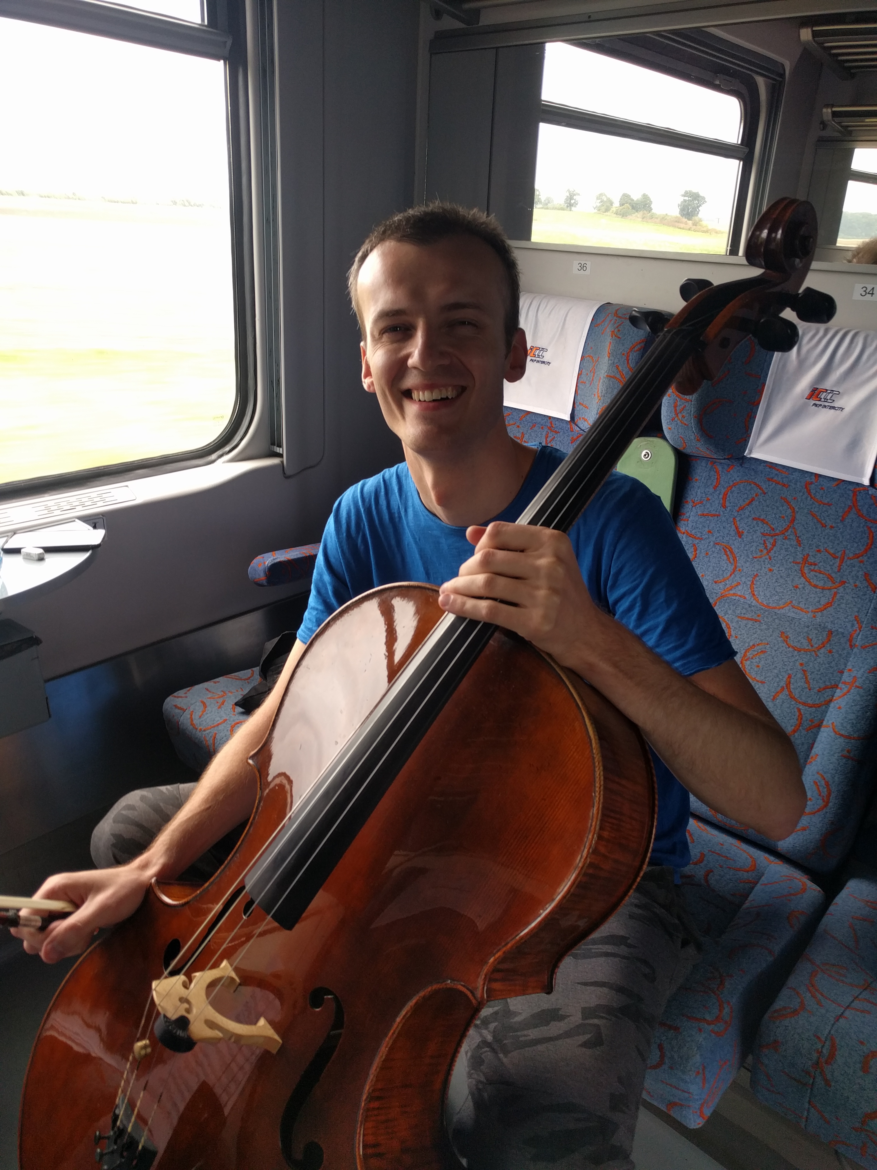
The train was comfortable and quick but there was no information display showing the upcoming stops, nor was there wifi. On the second leg of this trip we had a 6-seat compartment to ourselves and, in the next carriage along, so did a cellist who was doing some practice. I interrupted him briefly and found out that his name is Robert, he studied cello in Warsaw and now plays professionally in an orchestra in Szczecin. They are about to go on tour to Krasnogorsk. He was practising his part in a Mendelssohn string quartet.

IMG_20180831_114026

The day was grey and overcast and the Polish countryside was flat and pretty featureless – a good stretch to do on the rails. We are in Szczecin, proudly the capital of West Pomerania, an interesting city on the River Oder, with trams, churches, a new white Filharmonie and many grand streets with impressive architecture. A sign near the entrance to St Jacob’s Cathedral explains about the Pomeranian Way, the Baltic section of the pilgrim route to Santiago that we travelled along two days ago.

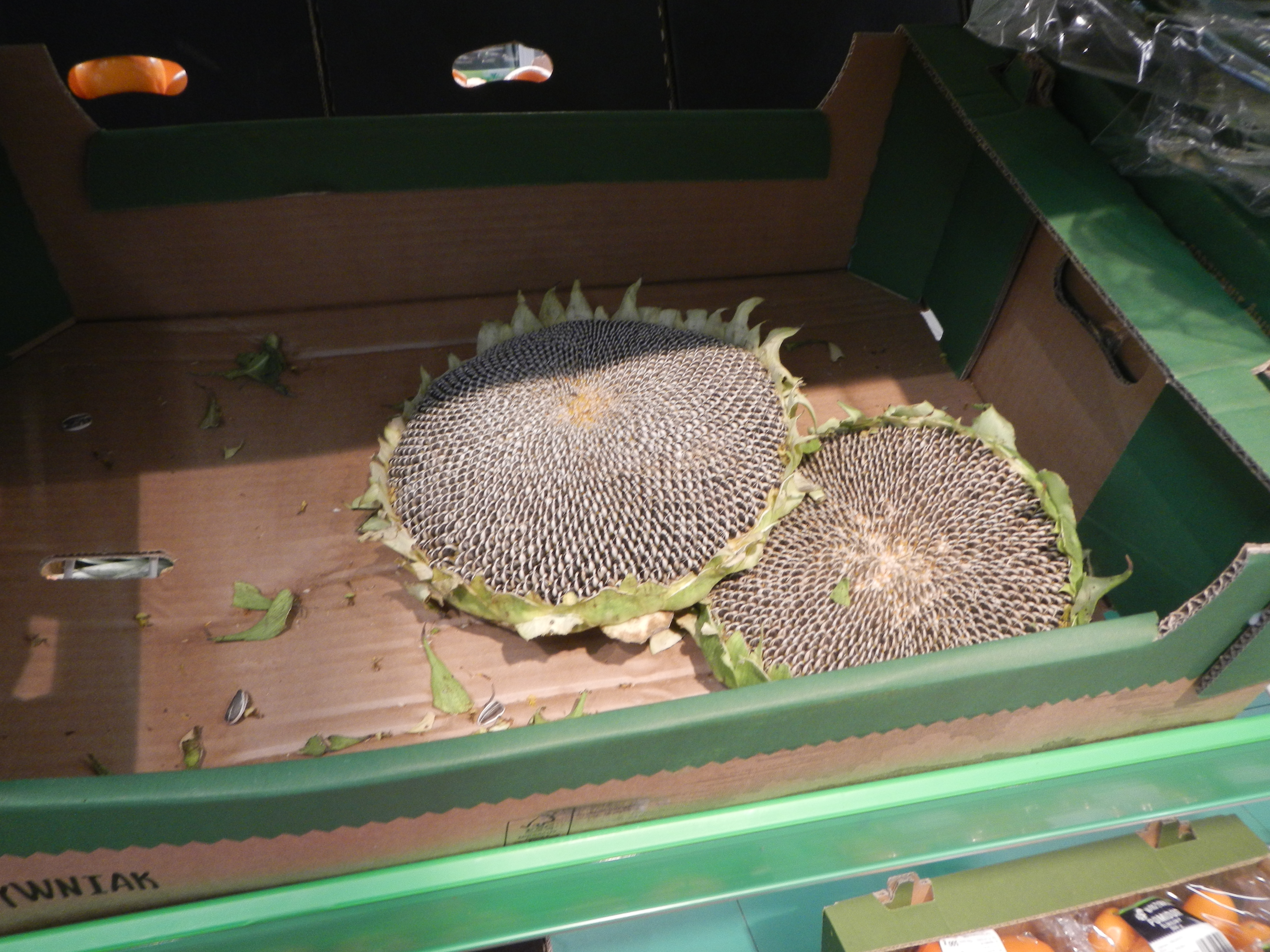
In the supermarket near our accommodation you can buy a whole sunflower head! Can’t do that in Foodland.

DSCN3485

On the pilgrim trail

30 August 2018

Yesterday we saw scallop symbols for the Santiago de Compostela pilgrim route fixed to trees along the road. We have seen many more today and this morning passed two walkers with scallop shells on their rucksacks. It’s a long way from here to there!

We had a couple of hills to climb and then descend with good views across the Vistula Lagoon from the top. Today has mostly been spent on quiet country roads through small villages as we crossed the flat farmland along the Baltic coast. Crucifixes and shrines were numerous, tractors were out reaping and ploughing, old blokes were fishing and riding their bikes.

We had a power supply problem to solve as the plug that worked throughout Scandinavia and Russia is not compatible with Polish power points. We found a small shop that had the solution we needed, but it was the first place we have come across that didn’t accept credit cards – and of course we had no zlotys. This was also an issue on the ferry across the Vistula, near Gdansk, but fortunately we had just enough Euros in cash and these were acceptable.

Gdansk has an impressive old centre. We are staying directly opposite the Basilica of St Mary, second biggest brick building in the world after Albi Cathedral.

Out of Russia again

29 August 2018

Kaliningrad to Frombork, Poland

Kaliningrad is proud of its past as Konigsberg, based on the historical photos on display, but it seems that little of this remains after two World Wars. It is now a busy city with lots of traffic, trolley buses, trams, Sovietsky apartments and statues and a few grand houses and buildings from more prosperous times. We managed our navigation by retreating to the footpath as much as possible.

On the way to Kaliningrad South station we stopped at a mobile phone shop where Ian bought a phone for under $100 to replace his recently deceased one. Then we noticed and followed the red line that had been painted on the footpath to guide World Cup visitors from the station to the FanFest.

A large statue in the Soviet style, presumably of Kalinin but not identified, dominates the approach to the station. As at many Russian train stations, this one requires the scanning of all luggage at the entry, so we unloaded everything and went in, to discover that there are only two trains each day to Mamonovo near the Polish border. We had missed the first and the second one was not until mid-afternoon. Timetables for local trains are not available online. Therefore we decided to cycle all the way.

Riding out of Kaliningrad was not too bad. We stayed on the footpath where possible and once out of the city fringe the traffic gradually decreased, the countryside became more scenic and the weather improved.

We reached the border at about 1pm, cruised through fairly quickly and were greeted in Poland by three stork nests, of which we saw none in Kaliningrad.

Now we are in Frombork, a small town on the Vistula Lagoon with a massive cathedral and memorials to Copernicus who lived here.

The tiles on the cathedral roof are being replaced – wonder who pays for that? Delicious dinner of fish and fried potatoes.

Unscheduled day in Siauliai

26 August 2018

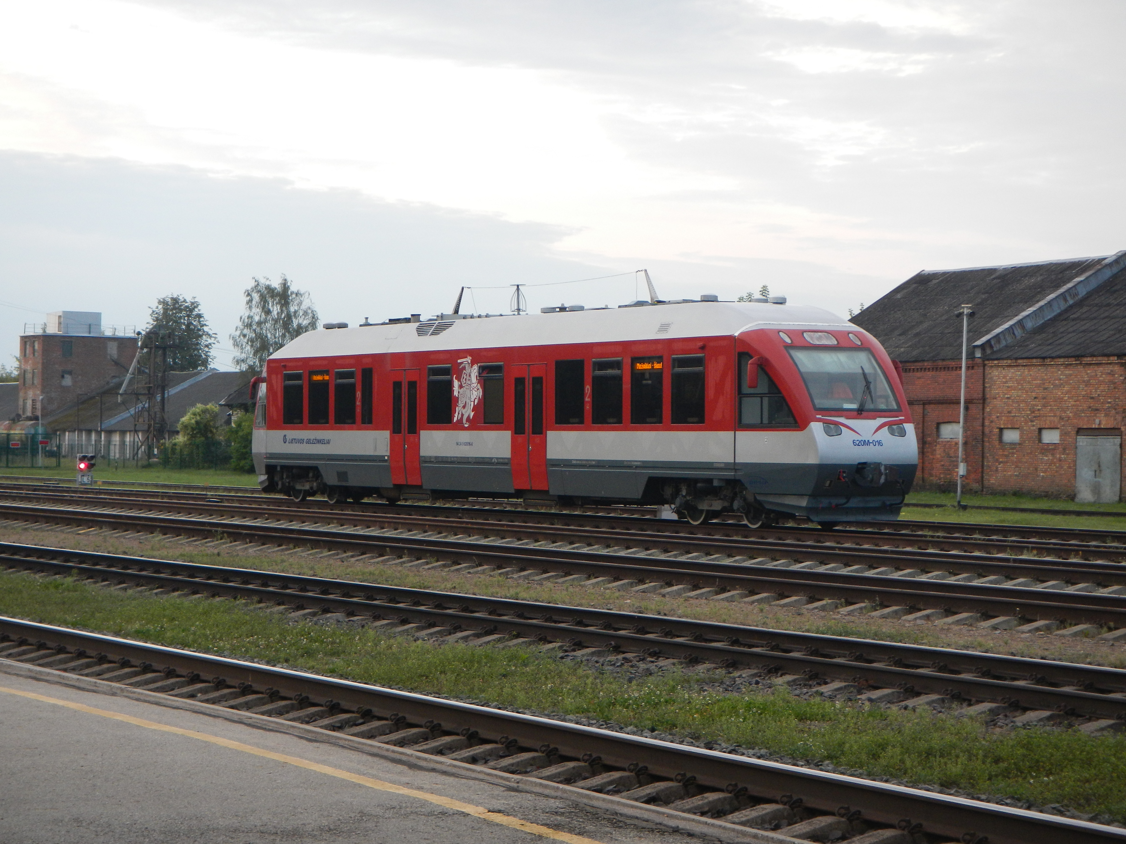
Mazeikiai to Siauliai to Klaipeda by train

Today’s plans fell apart! We left Mazeikiai early to take a train to Siauliai, thereby foregoing breakfast at the hotel. That part went OK (except for no breakfast). And seen from the train: a woman hand milking a cow in a field while nearby a man was scything the grass.

At Siauliai we intended to take the morning train to Klaipeda but, based on prior experience, we counted on the train not being booked out. It was! The next train at midday wasn’t booked out but the bicycle spaces were. Therefore we bought tickets for the 5.09pm train and came to terms with the necessity to spend the day in Siauliai.

DSCN3082

This is Lithuania’s 4th biggest city, probably best known for a nearby tourist attraction, the Hill of Crosses, a pilgrimage site since the 1830s. We could not bring ourselves to go there so concentrated on other local features of which there were plenty. Siauliai (pr. Shooly) has more museums than you’d expect including the Cat Museum, the Angel Museum, the Railway Museum (closed on weekends), the Photography Museum and the Bicycle Museum. We started with the latter which was good value for 2 Euros entry – and they also let us park our bikes inside. It displayed bikes from various eras and of a range of styles accompanied by photos and information highlighting the local factory where bikes continue to be manufactured.

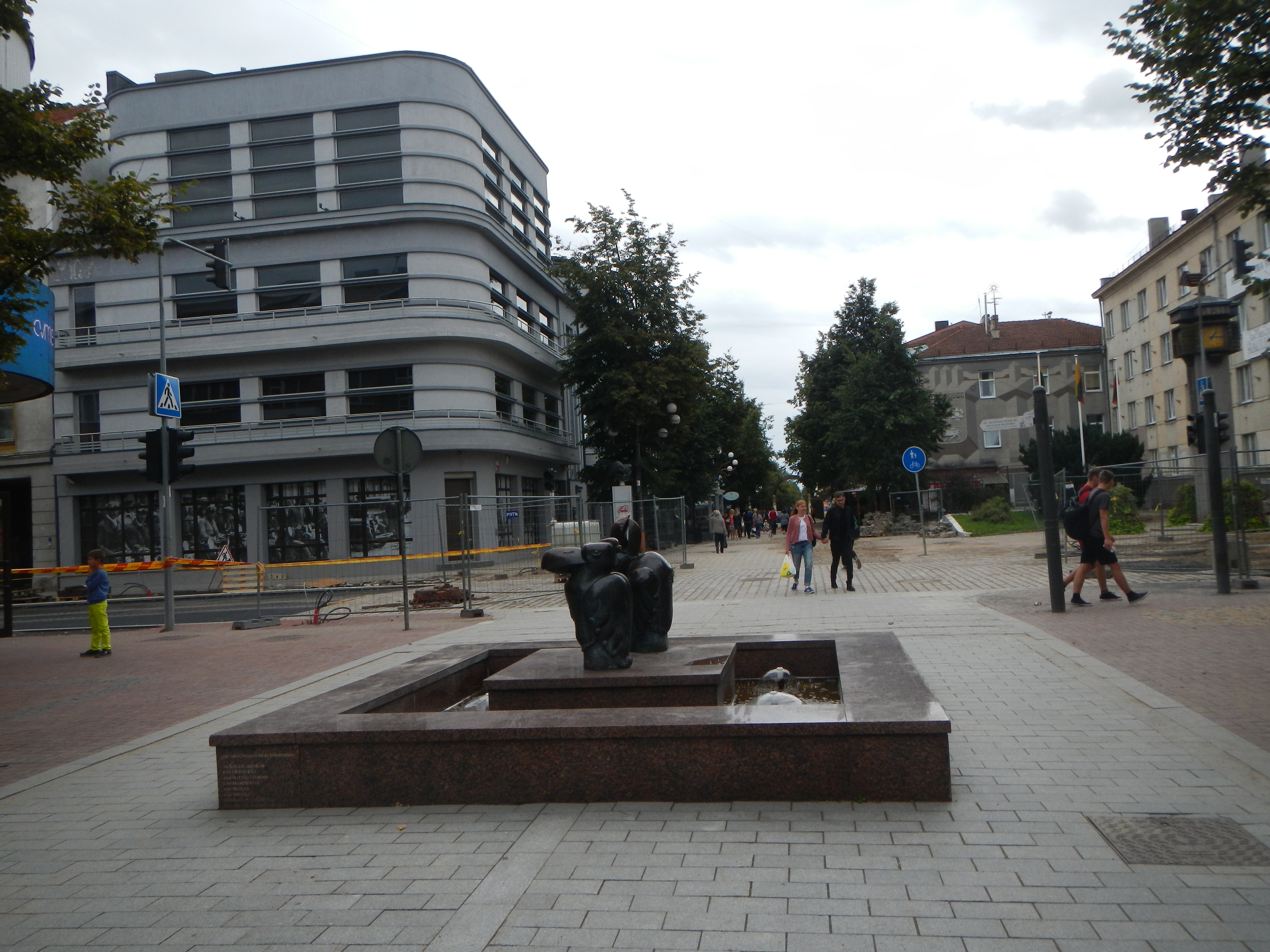
Siauliai the city has more than its share of decrepitude, but it is making progress with the renovation of the central pedestrianised area where one half is newly paved. The other half is in a state of apparently long-term disrepair with much of the paving dug up and left in piles. It is well served with better cafes and bakeries than we have seen for awhile.

DSCN3138

The local park by a lake has an iron fox, a labyrinth and water sports. There are interesting sculptures, monuments, murals, a university and a cathedral. Preparations were taking place for an outdoor concert in the city centre. The overcast sky turned to drizzle and rain in the late afternoon.

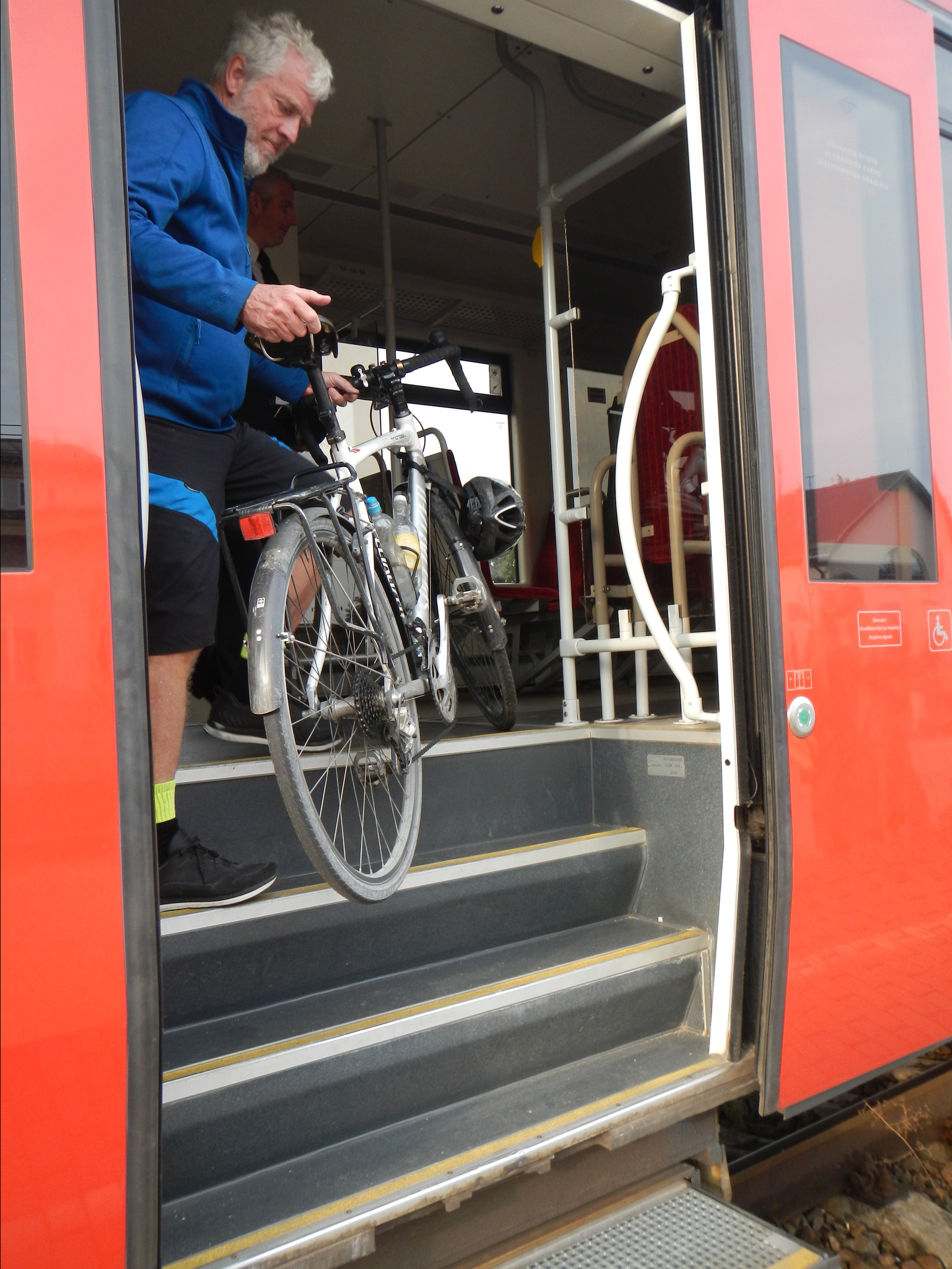
Eventually it was time to catch the train – we had precisely one minute to locate the correct carriage, unload the bikes, lift them up three steep steps into the train and get our panniers inside. About 20 seconds of this time were taken up by a woman in front of us who struggled to climb in with her heavy bags. Luckily for us, a security guard came to our assistance and we made it!

dscn3086.jpg

The train was slow and noisy and stopped at every station, making it a 3 hour trip to cover about 130km to Klaipeda on the Baltic Sea. On the way we counted over 20 stork nests and also saw cows, goats, vegetable gardens, abandoned industrial sites and many small villages. At one station, the train conductor alighted to collect windfall apples from a heavily laden tree near the platform.

Tomorrow morning we will explore Klaipeda.

Gravel road to Lithuania

25 August 2018

Riga to Jelgava by train – Jelgava to Mazeikiai by bike

We took an early morning train from Riga to Jelgava, 50km south, to give us a head start on a long day to Lithuania. Jelgava impressed us with its orthodox church, fine historic buildings and attractive public areas along the river and in the city centre.

Latvia is about to celebrate 100 years of nationhood and this is commemorated in Jelgava by an unusual public sculpture.

Our route commenced on a busy road but traffic lessened as we turned off on to secondary roads. Three storks were spotted early and, after that, many nests, but none occupied – either abandoned (indoor plants taking over) or maybe just vacated until next year. What did storks do before people were around to provide them with poles for their nests?

We had a good opportunity to observe Latvian farms. There was crop reaping occurring on several but otherwise pretty quiet. At a roadside shop we spoke to a Latvian tradie in his hi-viz gear who enthusiastically told us about his 2 month trip around Australia. At Auce, our halfway point, we had black bread, cheese and sausage bought at the Riga market, but only unchilled drinks could be found in the shop.

Soon after this the bitumen ran out and we were obliged to endure 30 km on loose gravel with clouds of dust covering us each time a vehicle passed.

At one stage I looked back to see if Ian was in sight and saw instead a man in black. He was an toothless Latvian man on a single speed clunker with a metal jerry can on his carrier. He had cruised past Ian and caught up to me. He stopped for a brief conversation in which we agreed, with no language in common, that the gravel road was bad, then he rode off.

The temperature was too warm (high 20s) for dusty riding but we slogged it out and reached the bitumen just before the border into Lithuania. Big road works were underway to improve a badly worn out road and these gave us the chance to test out new stretches of smooth hot mix that were inaccessible to cars.

On the approach into our destination, Mazeikiai, a Volvo had run off the road and got bogged in soft sand. We watched as some blokes in an Audi tried to tow it back on to the road with tyres spinning and smoking until the tow rope broke! Our hotel, located in an industrial area overlooking a truck depot, was both cheap and good and provided delicious Lithuanian food. However they had the underfloor heating going which made the room uncomfortably warm, so we opened up the windows and got both fresh air and high volume live music from the bar below.

Riga

23 August 2018

Purtsi to Valga, Estonia by bike – Valga to Riga, Latvia by train

It was cold and sunny at Purtsi this morning. We stopped for breakfast at Torva where the centre of town has been partly modernised with a big plaza and the rest has extensive road works in progress. It was a pleasant surprise (1) to find a cafe and (2) that it was open. Many Estonian towns have only a Coop or Konsum supermarket and little else.

We saw one stork today as it flew close by us with a stick in its beak, obviously doing some home maintenance before setting off for Africa.

Our destination was Valga another 30km down the road. As we approached Valga the road followed the Latvian border which was marked with black and white bollards.

The town is divided between Estonia and Latvia. It has an orthodox church of St Isidor with a cluster of onion domes and a huge bright white railway station. The big Maxima supermarket has a good fish selection, and in the entry a woman was selling delicious smelling smoked sausage and pork laid out on a long table.

We took the 2.37pm to Riga, a three hour trip at speeds we are accustomed to in Australia. It had wifi though and space for bikes. There is no integration of train services between the Baltic countries with each terminating its lines at or short of the border.

Arriving in Riga, our accommodation plans fell through and we had to make last minute arrangements before finding a Latvian beer in a shady park and a slightly overwhelming but good value buffet restaurant – too many food choices is not such a bad problem!